


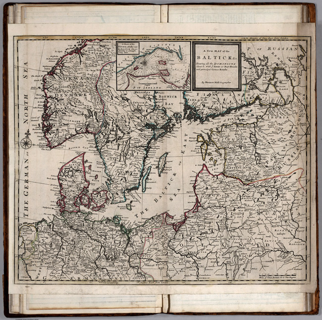
- Title: 1732 Map of Baltic Countries
- Publisher: Herman Moll
- Download: High-Res pdf
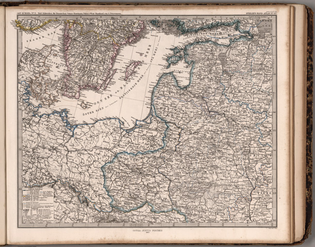
- Title: 1867 Map of Osteuropa
- Publisher: Adolf Stieler
- Download: High-Res pdf
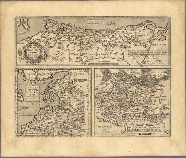
- Title: 1608 Map of Russiain Europe
- Description: 3 maps on 1 plate. Scale is given in order of maps listed.
- Publisher: Abraham Ortelius
- Download: High-Res pdf
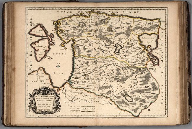
- Title: 1663 Map of Livonia
- Publisher: Nicolas Sanson
- Download: High-Res pdf
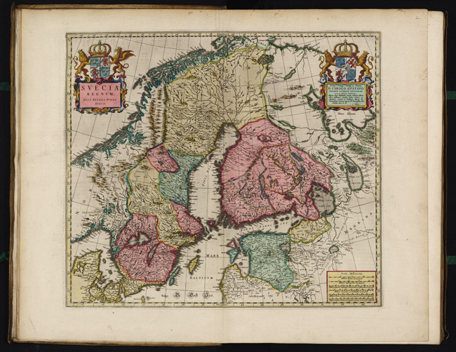
- Title: 1665 Map of Svecia Regnvm
- Description: Scala Miliarium, 19 Milliaria Dalica 7 1/3 uni grad = 6.9 cm [et al.]
- Publisher: Joan Blaeu
- Download: High-Res pdf
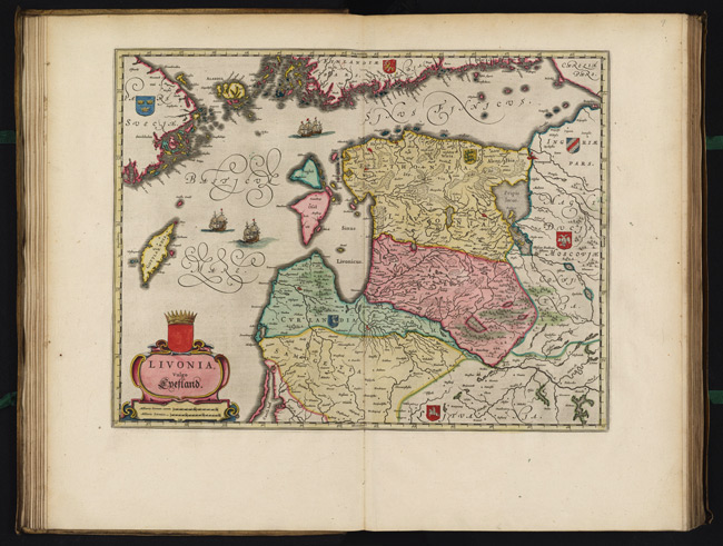
- Title: 1665 Map of Livonia Vulgo Lyefland
- Description: 10 Milliaria German. Comm: = 4.5 cm [et al.]
- Publisher: Joan Blaeu
- Download: High-Res pdf
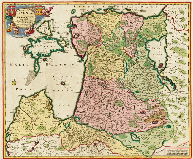
- Title: 1705 Map of Ducatuum Livoniae et Curlandiae Nova Tabula
- Publisher: Frederik de Wit
- Download: High-Res pdf
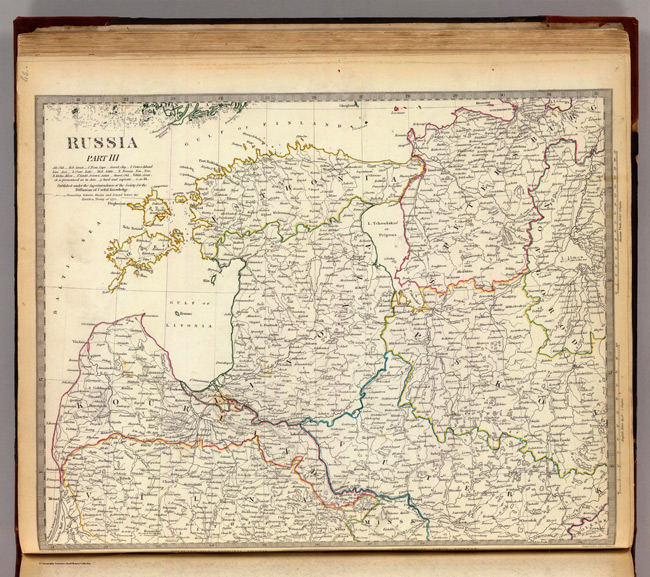
- Title: 1834 Map of Russia Part II
- Description: Engraved map. Relief shown by hachures. Provincial borders hand col. Source: Imperial atlas of Russia in Europe.
- Publisher: Chapman and Hall
- Download: High-Res pdf
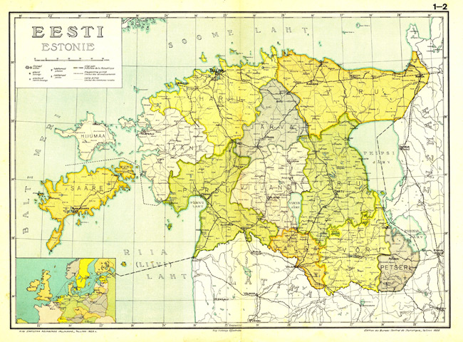
- Title: 1925 Map of Eesti Haldusjaotus
- Download: High-Res pdf
Copyright © 1993-2025 World Trade Press. All rights reserved.